Add Row
Add Element
cropper
update
Gulf Of America Luxury Living
update
Add Element
  • Home
  • Categories
    • luxury
    • homes
    • lifestyles
    • design
    • travel
    • events
    • boating
    • national parks
    • food
    • wildlife
    • Entertainment
    • boating
    • Politics
    • sharks
July 18.2025
2 Minutes Read

Could a Tsunami Hit Texas? Understanding the Risks and Preparedness

Satellite image depicting weather patterns in the Gulf of Mexico.

Understanding the Danger: Can a Tsunami Hit Texas?

The recent 7.3 magnitude earthquake off the coast of Alaska has sparked a tsunami warning that stretches across a 700-mile area. While the warning was lifted soon after, it brings to light an important question: Could a tsunami ever hit Texas? Earthquakes are often associated with tsunami risks, but the Gulf of Mexico, where Texas is situated, has a different seismic profile than that of the Pacific Coast.

Historical Context: Past Tsunami Events in the Gulf

Although large tsunamis are a rarity in the Gulf of Mexico, three minor tsunami events have been documented in the 20th century. These incidents shed light on the potential risks faced by coastal communities in Texas:

  • In October 1918, a tsunami was detected in Galveston, likely caused by seismic activity near Puerto Rico.
  • A 2.1-foot wave was recorded in Galveston in 1922, attributed to a local seismic event.
  • Freeport experienced a 0.6-foot wave after a significant earthquake in Alaska in 1964.

These historical events may seem minimal, but they highlight the need for preparedness in coastal areas even if severe tsunamis are less likely.

What Experts Say: Low Threat, But Not Zero

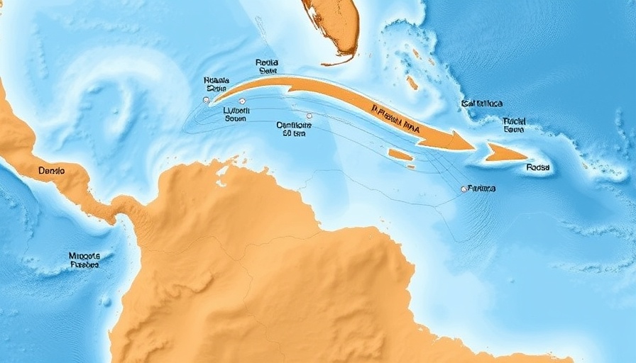
According to researchers with the U.S. Geological Survey and the National Tsunami Hazard Mitigation Program, while the risk of a significant tsunami affecting Texas is low, it is not impossible. The primary sources for potential tsunamis in this region would be local submarine landslides or earthquakes originating from the Caribbean plate. However, experts emphasize that preliminary models suggest a very low threat to communities along the Gulf Coast.

Preparing for the Unexpected: Community Awareness

Despite the relatively low risk, local populations should maintain an awareness of tsunami possibilities. This is aligned with broader emergency preparedness strategies that coastal communities should foster. Understanding evacuation routes, emergency plans, and possible sources of tsunami alerts can empower residents and mitigate panic in the event of an unexpected nautical calamity.

In Conclusion: Coastal Preparedness is Crucial

As the saying goes, it's better to be safe than sorry. While tsunamis in Texas remain unlikely, aligning community awareness and preparedness can have life-saving implications should a seismic event occur. Engaging local authorities on the importance of disaster readiness prepares communities for all types of emergencies, marking an important step in safeguarding their future.

Politics

0 Views

0 Comments

Write A Comment

*
*
Related Posts All Posts
07.17.2025

Gulf Coast Residents Facing Severe Flooding Risks Ahead of Tropical Storm

Update Millions Along the Gulf Coast Brace for Severe Flooding As a dangerous storm system churns across the Gulf Coast, millions are facing the risk of flash flooding, particularly in Louisiana, where rainfall could reach catastrophic levels. Forecasters have issued warnings of heavy rain, with predictions of up to a foot of rainfall in vulnerable areas, creating a looming threat to communities along the coast. The Threat of Stalled Storms In south-central Louisiana, areas could see rainfall rates of 2 to 3 inches per hour, overwhelming soil and drainage systems already strained by previous storms. The National Hurricane Center indicates that while the storm may not develop into a tropical system, the heavy rainfall poses significant risks. New Orleans is one of the most at-risk locations, particularly given its flood-prone infrastructure and already saturated grounds. Preparations in New Orleans In anticipation of the heavy rains, New Orleans officials have opened several sandbag distribution sites, urging residents to prepare for potential flooding. With all city buildings closed to the public, the emphasis has shifted to ensuring public safety amid increasing weather threats. Volunteers are stepping up to help fill sandbags, showcasing community spirit during the trying times. Flood Risk Across the Gulf Coast The flood risk isn’t limited to Louisiana; areas extending from Texas to Florida face increased threats, with a Level 3 of 4 risk indicated in south-central Louisiana. This includes major cities like Mobile, Alabama, and Gulfport, Mississippi. The storms may linger, leading to repetitious soaking of the same areas and exacerbating flooding risks. The Bigger Picture of Severe Weather This looming flooding threat is a stark reminder of an already tumultuous summer marked by severe weather across the nation. With climate change contributing to erratic weather patterns, the Gulf Coast has faced a series of floods that have devastated many communities. The current weather event exemplifies the need for enhanced infrastructure and preparedness plans to combat the intensifying threats posed by climate conditions. What Does This Mean for Residents? For residents in affected areas, the threat of flooding presents not only immediate concerns but also longer-term implications as climate change continues to affect storm patterns. Understanding these risks and taking proactive measures can be crucial in minimizing damage and ensuring safety during severe weather events. Stay safe and informed about weather updates, and consider preparing your home and surroundings before storms hit. The ongoing need for community resilience and preparation cannot be overstated.

07.16.2025

Tracking Invest 93L: What It Means for the Gulf Coast and Florida

Update Invest 93L: A Potential Storm on the Horizon As tropical moisture continues its relentless push toward the Gulf Coast, Invest 93L has emerged as a significant weather event to monitor. Currently, the Orlando area is experiencing heavy rain as this system develops, raising concerns for heavy rainfall along key corridors, particularly Interstate 10. According to the National Hurricane Center (NHC), the system has a 40% chance of evolving into a tropical depression within the next two days. Impacts Across the Gulf Coast The Gulf Coast communities, especially those in Alabama, Mississippi, and Louisiana, are bracing for increased rainfall as the system moves westward. The NHC has highlighted the region's warm waters and favorable atmospheric conditions, emphasizing a medium chance of tropical development. Such development may not significantly alter forecasts but will likely enhance flooding risks. Forecast and Flash Flooding Risks This week, Flash Flood Watches are already active in Louisiana, with rainfall totals projected between 3 to 6 inches and local amounts possibly reaching a foot. The threat of severe weather lurks, including waterspouts and tornadoes in any strong storms that develop. Two primary forecast pathways are under consideration for Invest 93L, each carrying distinct implications for the region. Potential Paths of Development The first suggested path indicates the system could remain close to land, potentially limiting cyclone development but still delivering heavy rains and squally weather to coastal cities like Panama City, Mobile, and New Orleans. The second potential track sees the system traveling further into the Gulf, providing it with more time to organize. This scenario could lead to a stronger storm but might also reduce overall rainfall along the coast except where the storm makes landfall. The Bigger Picture: What’s at Stake As residents prepare for the impacts of Invest 93L, the broader implications of tropical developments in the Gulf cannot be overlooked. Tropical storms and hurricanes have devastating effects on local economies, infrastructure, and community safety. Increased awareness and preparedness are crucial for mitigating these impacts, especially in areas prone to flooding. The upcoming days will be crucial in determining Invest 93L's path and potential threat level. Local authorities and meteorological teams remain on high alert as more data becomes available from Hurricane Hunter aircraft that will conduct surveys over the system, potentially shaping the forecast. Your Role During Tropical Events For individuals residing along the Gulf Coast, understanding the information surrounding weather events like Invest 93L is vital. Services available include local government alerts and updates from the National Hurricane Center, which provide critical information on storm developments and safety measures. Knowledge is power when it comes to weather preparedness; stay informed, and take action where necessary.

07.15.2025

Rising Cyclone Odds in Gulf of America: What to Expect

Update Increased Tropical Cyclone Risks for the Gulf Coast The National Hurricane Center (NHC) has updated its forecast, indicating a rise in the likelihood of a tropical cyclone forming in the northeastern Gulf of America within the next week. Recent computer models suggest that a defined area of low pressure, currently situated off the east coast of Florida, is intensifying the odds of storm development. Meteorologists at the NHC report that the chances of cyclone formation have jumped from zero to 30% in the next 48 hours and increased from 20% to 40% within the week. This forecast is critical for residents along the Gulf Coast as they prepare for potential high winds and inundating rains. What This Means for Florida and Its Coastline Currently generating disorganized thunderstorms, the low-pressure system is expected to trace a westerly path across Florida and into the northeastern Gulf of America. If conditions remain favorable, a tropical depression could emerge as early as mid-week. Even if a cyclone does not form, rainfalls are expected to be significant enough to induce flash flooding in various areas. Understanding the Factors in Play Environmental conditions are playing a crucial role in storm development. According to the NHC, should the low-pressure system remain offshore as it travels across the peninsula, the potential for cyclone formation becomes heightened. With the Atlantic hurricane season underway, the Gulf of America is under constant surveillance, especially given its history of volatile weather patterns. Keeping a Close Eye on the Tropics Across the broader North Atlantic and Caribbean regions, the NHC reports limited activity, with no immediate threats outside of this identified system. For coastal communities, this update from the NHC is a reminder of the importance of remaining vigilant as the season progresses. The organization emphasizes preparedness and encourages residents to have contingency plans ready. Looking Ahead: What Residents Can Do Residents in Florida and the Gulf region should heed this forecast and begin preparing for the potential impacts of severe weather. Essential preparations include securing outdoor items, having an emergency kit ready, and staying informed via local advisories. As storms can rapidly evolve, having a reliable communication plan ensures you stay connected with loved ones during harsh weather conditions. Engagement is Key With the tropical storm season ongoing, understanding these weather patterns becomes crucial for safety. Engaging with meteorological updates can provide insights into expected weather changes and support proactive measures that can minimize risk. Stay connected with your local weather services for real-time updates.

Terms of Service

Privacy Policy

Core Modal Title

Sorry, no results found

You Might Find These Articles Interesting

T
Please Check Your Email
We Will Be Following Up Shortly
*
*
*